Expertise in Platting Services
At Landco, our core expertise lies in delivering premier Platting Services. We meticulously divide and map land into plots, ensuring that each division and its description are clear, comprehensive, and adhere to regulatory standards. With a team of committed surveyors equipped with cutting-edge mapping tools, we consistently lead the way in platting excellence. Whether you're a land developer, a forward-thinking real estate attorney, or a meticulous title company, Landco is your dependable ally for timely, detailed, and faultlessly accurate platting solutions. Our mission goes beyond just mapping plots; we strive to provide our clients with a crystal-clear understanding of land divisions, associated rights, potential overlaps, and every intricate land detail. Our goal is to bolster confidence in land development projects and clarify any uncertainties pertaining to plot ownership and usage. For unparalleled expertise and absolute clarity in Platting Services, Landco remains your top pick. rewrite this and make it about elevation certificates.
ALTA Land Surveys
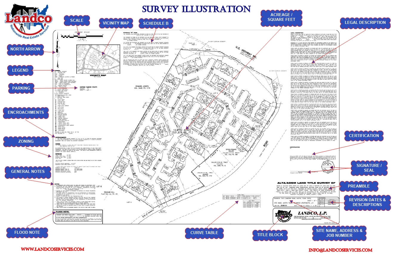
An ALTA Land Survey is a specialized examination of real estate, adhering to rigorous standards set forth by the American Land Title Association (ALTA), American Congress on Surveying and Mapping, and the National Society of Professional Surveyors. Widely recognized and employed, these surveys are predominant in commercial real estate evaluations.
Such surveys meticulously outline property boundaries, buildings, improvements, and any encroachments, all according to the most recent standards set in 2021. Beyond the foundational elements, clients can request inclusion of 20 "Table A" optional items, tailored to offer in-depth insights into specific property aspects.
For a comprehensive understanding of these standards and optional items, refer to the ALTA/NSPS Standards and Table "A" documentation. Given the meticulous nature and stringent demands of ALTA land surveys, they are often priced higher than other survey types, reflecting their unparalleled accuracy and detail.
Boundary Surveys
Boundary Surveys are meticulous examinations of real estate tailored to adhere to the minimum standards stipulated by the respective state where the property resides. While most states have clearly defined criteria for these surveys, there are exceptions where such mandatory guidelines don't exist.
In essence, Boundary Surveys resemble ALTA land surveys in their core purpose: they provide comprehensive visuals of property boundaries, architectural structures, enhancements, easements, and any potential property line intrusions. Even though they might not be as intricate as ALTA standards, they often suffice for lenders and other stakeholders in assessing property dimensions and constraints.
For regions lacking defined survey standards, ALTA becomes the default benchmark, ensuring uniformity and precision in the assessment of real estate boundaries.
Elevation Certificates
Elevation Certificates play a pivotal role in the world of real estate and community planning. Their primary purpose is to offer essential elevation data to align with community floodplain management rules. Moreover, they assist in accurately determining flood insurance rates and are crucial when pursuing a Letter of Map Amendment or Revision (LOMA or LOMR-F).
In simpler terms, this certificate provides a snapshot of how the lowest point of a structure stands relative to the base flood elevation, offering a clear perspective on potential flood risks. This knowledge is invaluable for both insurance considerations and structural planning.
The Vital Role of Topographic Surveys
A Topographic Survey is more than just a map—it's an insightful visualization of the earth's intricate landscapes. By capturing the precise contours, elevations, and relief of a specific terrain, these surveys offer an unparalleled view into both nature's marvels and human-made features. From rolling hills and serene valleys to constructed pathways, streets, and structural transitions, no detail is left unnoticed.
What sets a Topographic Survey apart is its versatility. Whether you're a landowner seeking to understand the nuances of your property, an engineer requiring precise terrain metrics, an architect crafting a masterful design, or a planner developing sustainable infrastructures, these surveys provide the foundational knowledge essential to informed decision-making.
Beyond individual stakeholders, Topographic Surveys are instrumental for governmental agencies, landscape architects, and developers. They drive decisions on land development, flood control, and environment conservation. In essence, they're not just surveys—they're comprehensive blueprints for a sustainable and well-planned future. Harness the power of detail, clarity, and strategic planning with a Topographic Survey. Your vision deserves nothing less.
Order Options
By providing the necessary details, expect a bid proposal in your inbox within 48 hours. Should you require services not mentioned below, don't hesitate to reach out. We're committed to ensuring your project's success and will gladly tailor our offerings to your needs.
- To place your request online - click here
- To place your request via e-mail - info@landcoservices.com
- To place your request by telephone - (832) 430-2012
- To place your request by fax - send information with site description to 281-606-1202.
Bid proposals are valid for 30 days
By providing the necessary details, expect a bid proposal in your inbox within 48 hours. Should you require services not mentioned below, don't hesitate to reach out. We're committed to ensuring your project's success and will gladly tailor our offerings to your needs.
- ALTA/NSPS Land Surveys
- Boundary Surveys
- Elevation Certificates
- Topographic Surveys
- Platting Services

